
Buy PDF guide

Buy PDF guide — 19.28 USD

PDF — 19.28 USD

Normandy and Brittany - Rouen - Étretat - Mont-Saint-Michel - Saint-Malo - Campsites on the coast, overnight parking areas for motorhomes near towns

Normandy and Brittany - Rouen - Étretat - Mont-Saint-Michel - Saint-Malo - Campsites on the coast, overnight parking areas for motorhomes near towns

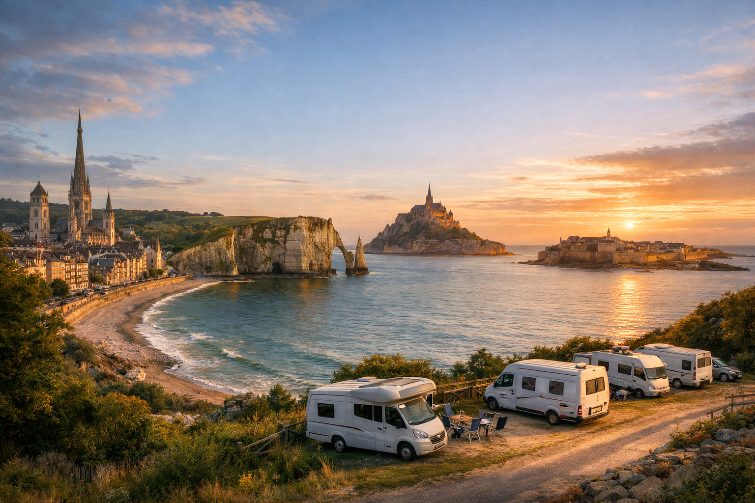
Follow Normandy and Brittany’s coast from Rouen’s medieval streets and the abbey ruins of Jumièges to Étretat’s white cliffs and the harbor charm of Honfleur. Then continue past the tidal wonder of Mont-Saint-Michel to Cancale, Saint-Malo, and Cap Fréhel, with sea-view campsites and convenient motorhome stopovers close to lively towns.

🚗 DAY-BY-DAY ROUTE

Ready-made country and city routes with daily plans, sights, transport and accommodation. Buy PDF guides for independent travel.

🚗 DAY-BY-DAY ROUTE


Day 1 — Rouen: a gentle start to the driving route

  • 🚗 Start and finish of the day: Rouen → Rouen. About 15–25 km around the city, with 30–50 minutes of actual driving time. This is a day without a long transfer: it’s convenient to pick up your rental car at the station or in the center, check in, and get to know the city at a relaxed pace. Main stops — Place du Vieux-Marché, the Gros-Horloge quarter, Rouen Cathedral. For parking, covered city garages such as Vieux-Marché, Pucelle, or Cathédrale / Office du Tourisme are convenient; the historic center is old and tight, so it’s better not to try driving right up to every attraction. Overnight stay — in central Rouen or at an outer-city base with an easy departure the next day. Road nuances: the center has many one-way streets, pedestrian zones, and paid parking; for the first day this is ideal, because the route is short and lets you get used to French road markings, roundabouts, and the urban rhythm. The day is realistic for a regular driver because it requires almost no long hours behind the wheel and leaves you with energy after a flight or train ride.


Day 2 — Rouen → Jumièges → Étretat

  • 🚗 Start: Rouen. Finish: Étretat. About 105–125 km, with 2.5–3 hours of actual driving time. Main stops along the way — Jumièges Abbey and one scenic break among the bends of the Seine. From Rouen it’s convenient to head out on the D982 toward Duclair and Jumièges: the road is beautiful, follows the river, and avoids the stressful traffic of motorways. In Jumièges it’s easy to make a cultural stop for 1–1.5 hours, then continue via the country roads of the Pays de Caux toward the coast. It’s better to arrive in Étretat before sunset on a weekend day rather than later: parking in the village is paid year-round from 9:00 to 19:00, and spaces closer to the cliffs fill up quickly. For the night, either a hotel in the village or a municipal campground / motorhome area at the entrance to town will work well. Road nuances: the last kilometers are on narrow local roads, and in high season there are many pedestrians; it’s best to drive into the center once and then continue on foot. The day is realistic because it combines one cultural stop and one coastal transfer without rushing.

Day 3 — Étretat: a day of cliffs and short local drives

  • 🚗 Start and finish of the day: Étretat → Étretat. About 20–40 km, with 40–70 minutes of actual driving time. Main stops — parking at the town entrance / Grand Val, a walk to Falaise d'Amont and the viewpoints above Falaise d'Aval; if you wish, a short drive to nearby rural panoramas or toward Yport / Fécamp for coffee and the sea. This is a day about fresh air, white cliffs, and an unhurried rhythm: it’s best to park once and collect most of the impressions on foot. In Étretat there is a motorhome zone next to the municipal campground, which is especially convenient for camper vans. Road nuances: parking in town is paid year-round, and congestion is higher on sunny days and weekends; do not drive down unofficial dirt tracks to the cliff edge, and use only official access points and paths for photos. In windy or rainy weather, the cliff edge can be slippery — something to keep in mind when planning. The day is realistic because it is hardly tiring behind the wheel and gives you a proper break between longer drives.

Day 4 — Étretat → Honfleur → Bayeux / Mont-Saint-Michel area

  • 🚗 Start: Étretat. Finish: a base on the way to Mont-Saint-Michel, ideally Bayeux, Carentan is unnecessary, or directly the Pontorson / Ardevon area. About 210–260 km, with 3.5–4.5 hours of actual driving time depending on the chosen base. Main stops — Honfleur and a short break at the Seine estuary; if you want an easier day, you can limit yourself to Honfleur only and then continue without extra detours. From Étretat the route goes along the coast and through the bridge junction near Le Havre / Honfleur, then continues on a fast motorway connection inland through Normandy. In Honfleur it is more convenient to park in the outer lots and walk to the old harbor. For the night, it makes sense either to choose a regular hotel along the way or already drive closer to Mont-Saint-Michel so that the next morning you can reach the parking area early. Road nuances: this day is longer than the previous ones, and toll motorway sections are possible; it’s best to leave the coastal zone and bypass the larger junctions before evening traffic. The day is realistic for a regular driver because the highway section is straightforward, and the longer distance is offset by good roads and one or two simple stops.

Day 5 — Bay base → Mont-Saint-Michel → Pontorson / Ardevon

  • 🚗 Start: a base in the Bayeux area or already near Pontorson. Finish: Pontorson / Ardevon / Roz-sur-Couesnon. If starting from a nearby base, expect 25–60 km and 40–80 minutes of actual driving; from Bayeux — about 140 km and 2 hours of actual road time. Main stops — the Mont-Saint-Michel parking complex, the village itself, and the abbey. A car is useful here for comfortably reaching the site, but it does not enter the rocky town: you leave the car in the official parking area, then take the free Le Passeur shuttle or walk along the causeway. Entry to the village is free; paid items are parking for motorized vehicles and admission to the abbey. In low season from September to June, parking is usually free in the evening and at night, and the first 30 minutes are free year-round; this is convenient for a sunset visit. It is better to stay overnight not on the island itself, but at the foot of the route — in Pontorson, Ardevon, or at a nearby campground. Road nuances: on days of major tides and in the middle of the day, visitor flow is at its heaviest; it’s best to book a time slot for the abbey in advance and be ready for the climb up the stairs with comfortable shoes. The day is realistic because the drive itself is short, and most of the time goes to sightseeing rather than driving.

Day 6 — Pontorson / Ardevon → Cancale → Pointe du Grouin → Saint-Malo

  • 🚗 Start: Mont-Saint-Michel area. Finish: Saint-Malo. About 60–85 km, with 1.5–2 hours of actual driving time. Main stops — Cancale, the harbor-side oyster tasting area, and Pointe du Grouin. This is one of the most enjoyable coastal days of the route: the road is not long, but it is full of air, light, and bay panoramas. In Cancale it’s best to leave the car in a town parking lot and walk down to the waterfront. Then a short drive to Pointe du Grouin via the D201; the cape has official access and parking, and after that it’s only on foot along the trails because the coast is protected and windy. By evening, the drive to Saint-Malo takes very little time. For the night — a hotel by the Intra-Muros walls, on Sillon Beach, or a campground / aire outside the old center if you’re in a motorhome. Road nuances: the cape can have strong crosswinds, and in season the parking fills quickly; in Cancale and Saint-Malo, it’s better not to try driving into the narrowest tourist streets. The day is realistic for a regular driver because the mileage is small and there is plenty of time for views, sea, and rest.

Day 7 — Saint-Malo: ramparts, beaches, and short drives

  • 🚗 Start and finish of the day: Saint-Malo → Saint-Malo. About 15–35 km, with 30–60 minutes of actual driving time. Main stops — Intra-Muros, Sillon Beach, and optionally the Rothéneuf or Alet area. For the city, this is a very convenient format: you can leave the car at Parking Paul Féval and use the free shuttles to the historic center, or choose a hotel with its own parking. If you want a driving flavor even on a city day, you can take a short coastal drive to the cliffs and beaches on the outskirts. For motorhomes, it’s more convenient to use official parking areas outside the old city core and enter the center on foot or by shuttle. Road nuances: in high season and at peak times, Intra-Muros can be awkward to access, and spaces inside and near the walls are expensive and fill quickly; it’s better to use a park-and-ride approach. The day is realistic because it serves as a breather before the final scenic drive through Brittany.

Day 8 — Saint-Malo → Cap Fréhel → Fort La Latte → Saint-Malo

  • 🚗 Start: Saint-Malo. Finish: Saint-Malo. About 90–120 km, with 2–2.5 hours of actual driving time. Main stops — Cap Fréhel and Fort La Latte. This is a classic car day: without a car it is inconvenient to travel between these points, while at your own pace the route is very beautiful and easy. First you drive west along the coast to the heath-covered headlands of Cap Fréhel, then make a short drive to Fort La Latte. At Cap Fréhel there is an equipped paid parking area; the site is environmentally sensitive, so it is important to walk only on marked paths; between Cap Fréhel and Fort La Latte there is a beautiful section of the GR34 trail, but by car you can also link these points without overloading the day. From the parking area to Fort La Latte you still need to walk about 800 meters. Road nuances: local roads are narrow but straightforward; in fog, wind, and rain the sea views may be less open, but more dramatic. The day is realistic because the main mileage is moderate, and the route is built around two vivid but logically connected stops.

Day 9 — Saint-Malo → Rennes or return the car in Saint-Malo

  • 🚗 Start: Saint-Malo. Finish: Saint-Malo or Rennes depending on your flight / train logistics. About 70–85 km to Rennes, with 1–1.25 hours of actual driving time; if returning the car in Saint-Malo, urban mileage will be 10–20 km. Main stops on the way — if you wish, Dinard for a short panoramic view of the Rance estuary, or a calm coffee break in the Rance valley. This is a final day without overload: you leave calmly after breakfast, refuel the car near the road before returning it, and make your way to the station or airport connection. If one-way rental is expensive, it makes sense to end the tour in Saint-Malo and continue by train. Road nuances: before returning the car, make sure to check the full-to-full policy, interior condition, and return time; when approaching stations and rental offices, allow an extra 20–30 minutes. The day is realistic because it leaves room for unexpected delays, refueling, and a calm end to the route.

Flight tickets

eSIM for travel

Buy PDF guide

Buy PDF guide — 19.28 USD

PDF — 19.28 USD