
Buy PDF guide

Buy PDF guide — 23.56 USD

PDF — 23.56 USD

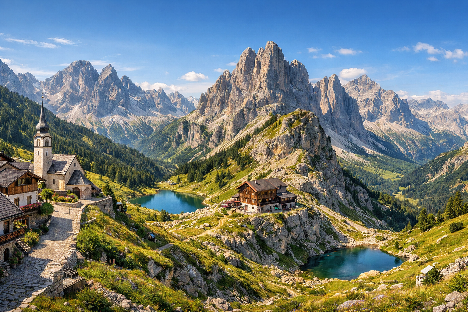
Italy, Dolomites. Alta Via 2: an eleven-day high-altitude trek from Bressanone to the Feltre area via the variant without difficult via ferratas. Difficulty: high. Season: July - August.

Italy, Dolomites. Alta Via 2: an eleven-day high-altitude trek from Bressanone to the Feltre area via the variant without difficult via ferratas. Difficulty: high. Season: July - August.

Cross the Dolomites on Alta Via 2, an eleven-day high-altitude trek from Bressanone to the Feltre area through jagged limestone peaks, green valleys, and dramatic mountain passes. This demanding route follows the easier variant without difficult via ferratas, linking places like Val di Funes, Selva di Val Gardena, Canazei, and Passo Rolle in the heart of the Italian Alps.

🥾 ROUTE BY DAY

Ready-made country and city routes with daily plans, sights, transport and accommodation. Buy PDF guides for independent travel.

🥾 ROUTE BY DAY


Day 1 — Bressanone: acclimatization on Plose and a panoramic walk

  • 🥾 It is best to devote the first day to a gentle introduction to the high-altitude rhythm. From Bressanone, it is convenient to take the Plose cable car and follow a scenic route through alpine meadows and forest sections around WoodyWalk and the trail to Palmschoss. This is a mountain walk with wide paths, good markings, and straightforward logistics, so it is suitable for an ordinary tourist without special equipment. The active part of the day is about 3–4 hours, difficulty is easy, distance is about 8–10 km, and elevation gain is around 250–350 m when using the lift. Along the way, you get soft lines of meadows, pastures, viewpoints toward the Odle peaks, and the distant chains of the Dolomites. In July and August, there can be bright sun and strong UV radiation during the day, so water, a hat, and an early start are important; after thunderstorms, the cable car and some sections may operate depending on the weather, so it is worth checking the lift status in the morning.


Day 2 — Val di Funes: trails at the foot of the Odle and Puez-Odle Nature Park

  • 🥾 This is one of the most beautiful and at the same time accessible days of the whole route: a valley and mid-mountain walk around Santa Maddalena and Zannes inside Puez-Odle Nature Park. The character of the walk is forest, alpine meadows, a mountain valley, and panoramic views of the serrated Odle ridge. An optimal option is a circular or linear route on well-known trails from Zannes, with stops at scenic meadows and a short visit to the park visitor center. The active part of the day is 4–5 hours, difficulty is moderate, distance is about 10–12 km, and elevation gain is around 350–500 m. The route suits an ordinary tourist because there are no ferratas, glaciers, or exposed ridges here; it is a popular marked network of trails where regular endurance matters more than technique. In high season, parking at popular starting points and buses may fill up early in the morning; after heavy rain, forest sections can be slippery, and patches of snow sometimes remain in shaded places in early July.

Day 3 — Selva di Val Gardena: Seceda and a gentle panoramic ridge hike

  • 🥾 The transfer to Val Gardena opens the most photogenic part of the tour. The day is dedicated to the famous Seceda area: ascent by cable cars and a walk along scenic trails between the upper stations and panoramic viewpoints. The character of the walk is high-altitude meadows, viewpoint trails, gentle descents, and broad ridge views. The active part is about 3–5 hours, difficulty is moderate, distance is 7–9 km, and elevation gain is usually no more than 250–400 m with smart use of the lifts. This option suits an ordinary tourist because the route can stay on popular marked trails without going onto steep summits and without long rocky climbs. The main value of the day is the famous panoramas of the sharp Odle walls, green pastures, and the amphitheater of the Val Gardena valleys. A seasonal detail: in July and August there are a lot of people here, and thunderstorms are possible after noon; it is better to go in the morning and check Seceda cableways opening hours in advance.

Day 4 — Selva di Val Gardena: Passo Sella and a safe scenic route near Sassolungo

  • 🥾 This day is inspired by the central part of Alta Via 2, but adapted to a non-technical format. From Selva, it is convenient to take a bus to Passo Sella and walk one of the classic panoramic routes at the foot of Sassolungo without entering a via ferrata and without difficult passes. The character of the walk is high-altitude pastures, stone amphitheaters, scenic terraces, and trails along broad slopes. The active part is 4–5 hours, difficulty is moderate, distance is 9–11 km, and elevation gain is around 350–500 m depending on the chosen loop. The route is suitable for ordinary tourists because it stays on popular trails around the pass where no helmet, harness, or mountaineering experience is needed. Along the way, the views of the Sella massif and the Sassolungo towers are especially good. Seasonally, it is important to remember that above 2000 m even in summer there can be cool wind, fog, and sudden weather changes; checking buses to Passo Sella and the return service is essential.

Day 5 — Canazei: Viel del Pan above Lake Fedaia

  • 🥾 After a short transfer to Canazei, it makes sense to walk one of the friendliest high-mountain routes in the Dolomites — Viel del Pan. It is almost a classic for ordinary travelers: a wide and mostly gentle trail with views of Marmolada and Lago di Fedaia. The character of the walk is a panoramic mountain trail, grassy slopes, pastures, and lake views. The active part of the day is 4–5 hours, difficulty is moderate, distance is about 10–12 km, and elevation gain is around 300–450 m when starting via the Belvedere lifts. The route is suitable without special equipment, as it is a well-known, well-trodden, and safe trail without ferratas and without dangerous rocky sections. In clear weather, this is one of the best viewpoints of Marmolada’s icy walls, but the route itself does not go onto the glacier and requires no technical skills. In July and August, the trail is very sunny with little shade, so water and sun protection are especially important; in bad weather, the views drop sharply.

Day 6 — Canazei: an easy day by the Fedaia / Pordoi passes and lakes

  • 🥾 To balance the overall high workload of the tour, it is best to make the sixth day easier. Short walks around Passo Pordoi or Lago di Fedaia along scenic trails and shoreline sections, without going up to steep summits, are a good fit. The character of the walk is pass, alpine tundra, lake, pastures, and viewpoints. The active part is 2.5–4 hours, difficulty is easy, distance is 5–8 km, and elevation gain is 150–300 m. This is a good recovery day before the longer southern transition of the route: you can walk calmly, take photos, rest in a rifugio, and stay within the zone of popular walking trails. For an ordinary tourist, such a day is ideal because the altitude is still felt, but there are no technical obstacles. Seasonal nuances: weather changes quickly on the passes, and strong wind sometimes picks up; in summer there may be queues for cable cars and buses, and on weekends parking at popular spots fills especially early.

Day 7 — Passo Rolle: Baita Segantini and the main panorama of Pale di San Martino

  • 🥾 The transfer to the Passo Rolle area shifts the route to the southern half of Alta Via 2 and immediately provides a very strong but safe hiking day. The classic Passo Rolle — Baita Segantini walk follows a comfortable wide trail or gravel road and is considered one of the best scenic walks in the region. The character of the route is high-altitude meadows, pastures, mountain ponds, and the massive rock walls of Pale di San Martino. The active part is 2.5–4 hours round trip, difficulty is easy, distance is about 6–8 km, and elevation gain is around 200–300 m. It is excellent for an ordinary tourist: the path is easy to follow, very popular, requires no technical skills, and lets you feel the atmosphere of a big mountain Alta Via without ferrata risk. The best time is early morning or late in the day for soft light on Cimon della Pala. In July and August, the place is very popular, and after thunderstorms the dirt sections may be wet.

Day 8 — Passo Rolle: Cristo Pensante via the safe variant

  • 🥾 This is the most “high-altitude” day of the tour in terms of feeling, but it still remains within safe non-technical hiking. The route to Cristo Pensante del Castellazzo from the Passo Rolle area usually follows a clear trail via Baita Segantini and then to a viewpoint against the backdrop of Pale di San Martino. The character of the walk is a mountain ridge without mountaineering, alpine meadows, rocky but popular trails, and powerful panoramas. The active part is 4.5–6 hours, difficulty is moderate, distance is about 10–12 km, and elevation gain is around 450–650 m depending on the exact variant. For an ordinary tourist, the route is suitable in good weather and with solid basic fitness because it remains a walking and popular route, without the need for a harness or helmet; however, this is no longer a walk “in sneakers,” but a full mountain day. Seasonally, it is important to check for lingering snow in early July, visibility, and the thunderstorm forecast: in bad weather, it is better to replace the route with a lower one.

Day 9 — Val Canali: Villa Welsperg and calm trails in Paneveggio Park

  • 🥾 After two high-mountain days, a gentler natural rhythm is needed. The transfer to the Val Canali area and a walk around Villa Welsperg, the visitor center of Paneveggio Pale di San Martino Park, provide an ideal recovery day. The character of the walk is forest, valley, streams, wet meadows, thematic nature trails, and park clearings. The active part is 2–3.5 hours, difficulty is easy, distance is 4–7 km, and elevation gain is minimal or up to 150 m. This is a route for an ordinary tourist in the purest sense: comfortable paths, clear infrastructure, the chance to start from the visitor center, and the ability to adjust the walk length based on how you feel. Here it is good to observe the “greener” Dolomites — not only rocks, but also living forest ecosystems. In season, rainy spells should be taken into account: after a downpour, trails in the valley may be damp, but this kind of weather makes the forest and streams especially beautiful.

Day 10 — Feltre: Croce d'Aune and a final walk along the southern spurs of Alta Via 2

  • 🥾 The final base in Feltre allows for a beautiful finish to the route in the zone where Alta Via 2 descends toward the southern foothills. The best format for the day is a trip to Croce d'Aune and a walk along safe trails and old military/shepherd tracks on the southern slopes of the Vette Feltrine without entering technical sections. The character of the walk is forest, mountain meadows, the southern spurs of the Dolomites, and viewpoints above the Veneto plain. The active part is 3–5 hours, difficulty is moderate, distance is 8–10 km, and elevation gain is around 300–500 m. The route suits an ordinary tourist because it starts high near the pass and allows you to choose a non-technical scenic option instead of a full long Alta Via stage. Here the change in the character of the mountains is especially noticeable: less harsh “northern” alpine geometry and more soft pre-Alpine lines. Seasonally, heat on the lower slopes and the schedule of the Feltre – Croce d'Aune bus line are important.

Day 11 — Feltre and Dolomiti Bellunesi: a gentle final day in the national park

  • 🥾 It is best to make the last day contemplative and not too long: a walk in an accessible part of Parco Nazionale Dolomiti Bellunesi or along lower trails near the park entrances close to Feltre. The character of the walk is forest park, stream gorges, botanically interesting slopes, and scenic clearings. The active part is 2.5–4 hours, difficulty is easy, distance is 5–8 km, and elevation gain is 150–300 m. This is a safe ending to a big tour: no rush, no long transfers, with the opportunity to stop by the Feltre tourist office and close the route in the footsteps of Alta Via 2. For an ordinary tourist, this format is best before departure: the trails require no special gear, and the park gives the feeling of a true finale in nature, not just a transfer. In July and August, the southern side may be hotter than the northern Dolomite valleys, so it is better to start early and not underestimate water needs.

Flight tickets

eSIM for travel

Buy PDF guide

Buy PDF guide — 23.56 USD

PDF — 23.56 USD