
Buy PDF guide

Buy PDF guide — 12.85 USD

PDF — 12.85 USD

Italy, Dolomites. Alta Via 1: a six-day trek along the southern part of the route from the Lagazuoi and Cinque Torri area through the Pelmo and Civetta massifs to La Stanga. Difficulty: high. Season: July - September.

Italy, Dolomites. Alta Via 1: a six-day trek along the southern part of the route from the Lagazuoi and Cinque Torri area through the Pelmo and Civetta massifs to La Stanga. Difficulty: high. Season: July - September.

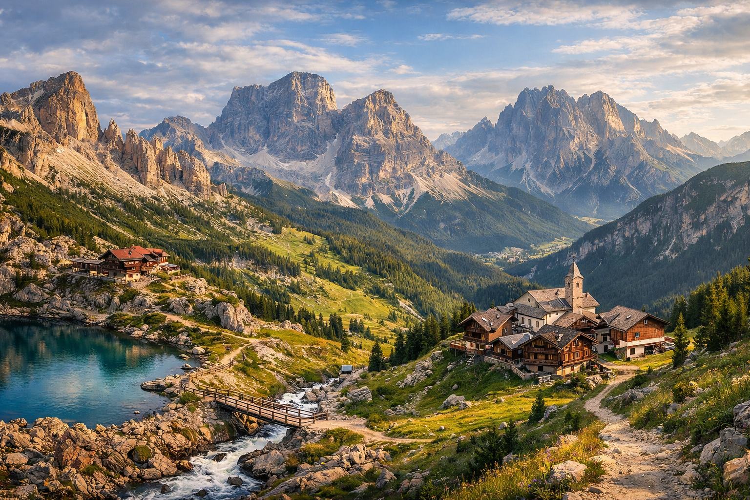
Cross the southern Dolomites on Alta Via 1, a demanding six-day trek from the dramatic towers of Lagazuoi and Cinque Torri through the wild valleys beneath Pelmo and the sheer walls of Civetta to La Stanga. Best hiked from July to September, this is a high-difficulty route of panoramic ridgelines, alpine huts, and some of Italy’s most unforgettable mountain scenery.

🥾 DAY-BY-DAY ROUTE

Ready-made country and city routes with daily plans, sights, transport and accommodation. Buy PDF guides for independent travel.

🥾 DAY-BY-DAY ROUTE


Day 1 — Passo Falzarego / Lagazuoi: panoramic mountain walk

  • 🥾 The day is devoted to a high-altitude but straightforward and popular walk in the Lagazuoi area. The safest and most practical option for an ordinary traveler is to take the Lagazuoi cable car from Passo Falzarego, then follow a scenic route on wide marked trails around the upper station and walk back down to the pass on the classic trail, without entering the war tunnels and without any via ferrata. Character of the walk: high alpine plateau, stone terraces, panoramas of the Ampezzo Dolomites, and grassy slopes. Active part of the day: about 3.5–5 hours. Perceived difficulty for the day is moderate, but because of the altitude the route requires a calm pace; approximately 7–9 km and mostly downhill, with local climbs of up to 200–300 m. This day suits an ordinary tourist because the cable car makes the start much easier, the trails are well known and clearly marked, and the technically difficult military sections and steep equipped lines can be excluded completely. The views are especially impressive in the morning and toward evening, but it is important to remember seasonal details: in July there can still be patches of snow on northern sections, after a thunderstorm the limestone and gravel become slippery, and you should check the last cable car down or its closing time in advance. If the forecast is unstable, it is better to stick to a short panoramic loop near the upper station and descend early.


Day 2 — Cinque Torri: meadows, rocks, and an easy historical-nature loop

  • 🥾 On the second day the route moves into the Cinque Torri area, one of the most convenient places for beautiful hiking without special gear. A convenient start is from Bai de Dones with the chairlift up to Rifugio Scoiattoli, or on foot via trail 439 if you want more effort. Then the best option is to make a loop walk around the rock towers and through the open-air museum, where the paths run across alpine meadows, sparse woodland, and broad scenic ledges. Character of the walk: mountain meadows, pine sections, limestone towers, viewpoints. Active part of the day: 3–4.5 hours. Difficulty is easy or moderate depending on the ascent option; approximately 5–8 km, elevation gain 150–400 m. This area is very suitable for ordinary tourists: the trails here are short, popular, and easy to navigate, while the hardest rock routes stay off to the side. It is also a good day both for acclimatizing to the altitude and for a relaxed photography-friendly pace. In the July–September season the place is very popular, so it is best to use the parking and lifts early in the morning; thunderclouds are common in the afternoon, and there is almost no shade in the open meadows, so bring water, a hat, and sun protection.

Day 3 — Passo Staulanza / Città di Fiume: transfer toward Pelmo through Val Fiorentina

  • 🥾 The third day connects the southern Alta Via 1 with the Monte Pelmo area. The most realistic and safe option for a hiking tour is to transfer to Passo Staulanza or the Selva di Cadore valley and walk to Rifugio Città di Fiume on the classic marked trail, without going onto the high passes around the massif itself. Character of the walk: alpine pastures, forest sections, wide grassy slopes, and the huge stone wall of Pelmo right before your eyes. Active part of the day: 3–5 hours. Difficulty is moderate; approximately 7–10 km, elevation gain 350–550 m. This is a good “transition” day after the transfer: the trail is well known, without exposure and without any need for a helmet or protection, and the Città di Fiume refuge itself is one of the classic landmarks of the southern section of Alta Via 1. If you still have energy, you can continue briefly along the pasture trails toward viewpoints and return the same way. Seasonal details: in July damp ground and residual snow can remain on shaded sections above 1900 m, while in August and early September it gets hot here on open slopes during the day, so it is better to start early. In low cloud Pelmo may “close up,” but the day still remains pleasant thanks to the flower meadows and gentle terrain.

Day 4 — Mondeval and Pelmetto: a long panoramic walk at the foot of Pelmo

  • 🥾 This is the fullest day in the Pelmo area, but without technical difficulties. The recommended route is a long panoramic walk on the lower and middle trails of the Mondeval / Pelmetto area with broad views of Pelmo and the neighboring valleys, without circling the whole massif and without crossing high rocky passes. Character of the walk: alpine valley, meadows, sparse forest, panoramic saddles, and gentle scree sections. Active part of the day: 5–7 hours. Difficulty is moderate, but the day is physically long; approximately 10–13 km, elevation gain 450–700 m. For an ordinary tourist the route works well because it stays on known walking trails, requires no scrambling, and includes no ferrata, and if you get tired it can easily be shortened to a shorter walk from Passo Staulanza or from the Santa Fosca / Pescul area. This is a day for the “big” Dolomite scenery: wide pastures, changing light on Pelmo’s north face, and a real sense of space. It is important to consider the weather: after heavy rain some meadow sections become muddy, and wind rises quickly on the open saddles. In late August and September the evenings are colder, so a warm layer is useful even after a sunny day.

Day 5 — Alleghe / Civetta: lake and a safe mountain route to Rifugio Coldai

  • 🥾 The fifth day shifts the focus to the Civetta massif. For a hiking tour without special equipment, the best choice is a route from the Palafavera area or with partial use of the lifts in the Alleghe area to Rifugio Coldai and, if you still feel strong, to Lago Coldai. Character of the walk: mountain forest at the start, pasture slopes, an alpine lake, and the great limestone walls of Civetta. Active part of the day: 4.5–6.5 hours. Difficulty is moderate; approximately 9–12 km, elevation gain 550–750 m depending on the starting point. Why this route suits an ordinary tourist: the trail to Coldai is very well known, it is a classic walking ascent on CAI markings without mountaineering elements, and the turn to Lago Coldai remains within the scope of ordinary mountain hiking. The most difficult sections of Alta Via 1 farther south, linked to ridge detours and harsher terrain, are not included here. Seasonal details: in July it can still be cool and windy by the lake, in August there are many people and it is worth starting earlier, and in September the light is softer and more beautiful, but the day is already noticeably shorter. If thunderstorms are forecast for the afternoon, it is better to stop at Rifugio Coldai and not linger on the open slopes.

Day 6 — La Stanga and the southern edge of the Dolomiti Bellunesi: a forest finale walk

  • 🥾 The final day is best kept gentler after several mountain stages: transfer toward La Stanga and walk the lower trails on the southern edge of Parco Nazionale Dolomiti Bellunesi, with an emphasis on forest, river valley, and a calm exit from the high-mountain part of the route. A good option is a route in the Val Cordevole / Valle Imperina area or a short climb by road and trail toward Pian dei Gat, without the ascent that would already require a full push to Rifugio Bianchet. Character of the walk: forest, valley, water, historical-nature trails, southern foothills of the Dolomites. Active part of the day: 2.5–4.5 hours. Difficulty is easy; approximately 5–9 km, elevation gain 150–350 m. Such a day is ideal for an ordinary tourist: these are marked walking trails and roads in the natural park without high-altitude exposure, with the option to combine a walking day with the visitor center in Valle Imperina. Seasonal details: lower down in July and August it can be noticeably hotter than in the upper Dolomites, so it is better to walk in the morning; after heavy rain some forest trails may be wet, and the return bus timetable from the valley should be checked in advance. It is a good soft finale before departing to Belluno or for the train.

Flight tickets

eSIM for travel

Buy PDF guide

Buy PDF guide — 12.85 USD

PDF — 12.85 USD