
Buy PDF guide

Buy PDF guide — 21.42 USD

PDF — 21.42 USD

Italy, Dolomites. Alta Via 1: a classic multi-day trek from Lake Braies to La Stanga with overnight stays in mountain huts. Difficulty: medium or high. Season: July - September.

Italy, Dolomites. Alta Via 1: a classic multi-day trek from Lake Braies to La Stanga with overnight stays in mountain huts. Difficulty: medium or high. Season: July - September.

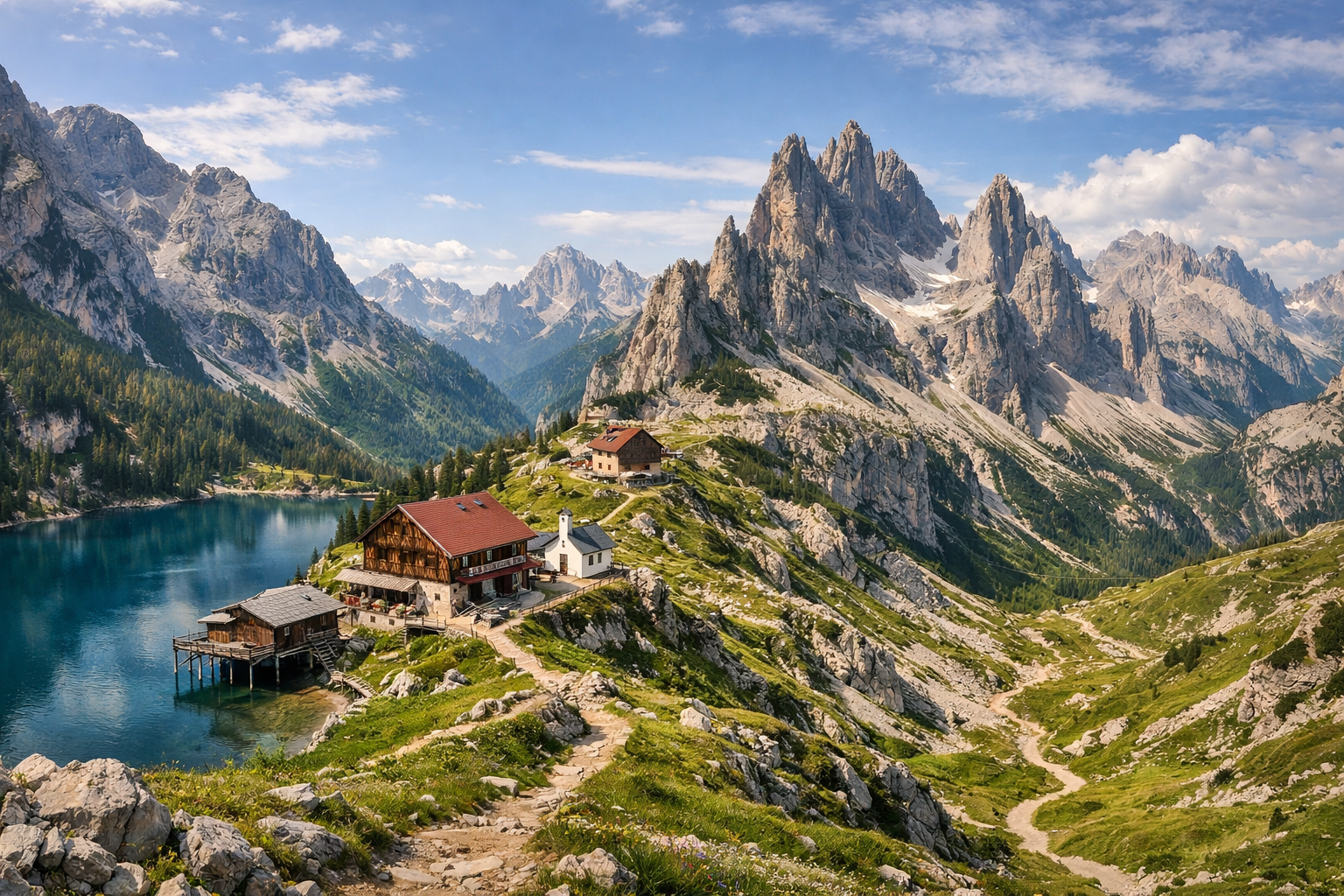
Alta Via 1 leads you through the heart of the Dolomites, from the turquoise waters of Lake Braies to the quiet finish at La Stanga. This classic hut-to-hut trek threads past jagged peaks, high passes, and iconic rifugi, offering a rewarding medium to challenging adventure best hiked from July to September.

🥾 ROUTE BY DAY

Ready-made country and city routes with daily plans, sights, transport and accommodation. Buy PDF guides for independent travel.

🥾 ROUTE BY DAY


Day 1 — Lago di Braies → Biella / Sennes area: lake, forest, and the first high-altitude plateau

  • 🥾 The route starts at Lago di Braies, one of the most beautiful lakes in the Dolomites. First comes a short walk along the shore, then the marked Alta Via 1 climbs through forest and rocky but straightforward trails to the high Fanes–Senes–Braies plateau. The active part of the day usually takes about 5.5–7 hours depending on whether you stay overnight at Rifugio Biella or Rifugio Sennes; expect around 11–16 km, with roughly 900–1200 m of elevation gain. Difficulty: moderate leaning toward high because of the long climb on the first day, but the route is suitable for a regular hiker without special gear: this is a popular marked trail where you do not need a helmet, harness, crampons, or climbing skills. The scenery changes gradually: emerald lake, dark conifer forest, alpine meadows, and wide views of the Croda del Becco massif. In July there may still be patches of snow on the upper sections, and in September the days are noticeably shorter and the evenings colder. In peak season, huts almost always require early booking, and access to the lake by bus and parking is regulated in advance in summer.


Day 2 — Biella / Sennes → Fanes: high plateau, pastures, and broad valleys

  • 🥾 The second day unfolds across open high-mountain terrain: plateau landscapes, gentle grassy slopes, karst formations, and spacious valleys with classic Dolomite views. The walk to Rifugio Fanes usually takes about 4–5.5 hours; expect 10–14 km, with moderate elevation gain totaling around 300–600 m, alternating short climbs and gradual descents. Difficulty: moderate. This is one of the most pleasant and mentally easy days of the route because the trails are wide, easy to follow, and very popular with hikers. Along the way there are many pastoral panoramas, bright meadows, and viewpoints that are ideal for long breaks. For a regular hiker, the day is good because it does not require technical preparation and is not overloaded with steep dangerous sections. Seasonal notes: after thunderstorms, limestone rocks become slippery, so it is better to start early; in July and August the sun on the plateau is harsh and there is little shade, so water, a hat, and sun protection are essential.

Day 3 — Fanes → Lagazuoi: valley, mountain pass, and one of the most spectacular panoramic huts

  • 🥾 One of the most beautiful days on Alta Via 1: the trail leads through the Fanes valley into harsher rocky landscapes and then climbs toward the Lagazuoi area. The active part of the day usually lasts about 5.5–7 hours; expect 10–13 km, with roughly 700–1000 m of elevation gain. Difficulty: moderate or high because of the long final climb, but not technical. The route is suitable for a normally fit hiker without special equipment, as long as you stay on the classic marked Alta Via 1 line and do not branch off into wartime tunnels or via ferrata routes. The views here are especially dramatic: gray walls, broad saddles, stone ledges, and an almost lunar landscape near the high-altitude hut. In clear weather, sunset at Rifugio Lagazuoi is a highlight in itself. An important nuance: do not confuse the regular trekking approach to the hut with the historic tunnels and ferrata routes nearby; for this itinerary only the safe walking option is chosen. If the weather worsens, your pace on the rocky upper section will drop noticeably.

Day 4 — Lagazuoi → Cinque Torri / Scoiattoli: scenic trails, wartime history, and an easy transition

  • 🥾 After a high-altitude overnight stay, this day is shorter and more scenic: a descent and traverse into the Cinque Torri area along well-known trails among tower-like rock formations, meadows, and panoramic saddles. The active part usually takes 3.5–5 hours; expect 7–10 km, with moderate elevation gain, mostly descent plus short climbs. Difficulty: moderate. This day is especially convenient as a half-rest day because it allows you to walk without rushing, take photos, and, if you wish, visit the open-air exhibitions in the Cinque Torri area. The route suits a regular hiker: there are many popular marked trails here, and if necessary you can use cable cars and local transport in the Cortina / Bai de Dones area for logistics. Seasonal notes: in July–August it can get very crowded here in the middle of the day, so it is better to start early; in fog, navigation becomes more difficult, although the trails are generally obvious.

Day 5 — Cinque Torri / Scoiattoli → Città di Fiume: meadows, Passo Giau, and views of Pelmo

  • 🥾 A classic crossing through one of the most photogenic parts of the route: from the Cinque Torri area, the trail leads to Passo Giau and then onward toward Pelmo and Rifugio Città di Fiume. The active part of the day takes about 5.5–7 hours; expect 12–15 km, with around 500–800 m of elevation gain. Difficulty: moderate. Visually, the day is very varied: green meadows, gentle slopes, scenic descents, and then the grand silhouette of Monte Pelmo. For a regular hiker, this stage is good because it follows well-known, safe, and popular trails without any alpine technical elements. The main challenge is the length of the day and sun exposure, not the terrain itself. In peak summer, the pass and surrounding trails are popular with day hikers, so it is better not to postpone water and food until the very end of the stage; by September, evenings are already noticeably colder and the weather can deteriorate quickly.

Day 6 — Città di Fiume → Vazzoler: valleys at the foot of Civetta and forest sections

  • 🥾 The route heads south into a more wooded and quieter part of Alta Via 1, passing beneath the Pelmo and Civetta massifs. The active part of the day usually lasts 5–6.5 hours; expect 10–13 km, with roughly 500–700 m of elevation gain and significant cumulative ups and downs along the way. Difficulty: moderate. This is a fine hiking day with a beautiful alternation of open meadows, rocky trails, and conifer forests, and the finish at Rifugio Vazzoler feels especially cozy thanks to its green basin setting and proximity to the alpine garden. For a regular hiker, the stage is suitable if walked at a calm pace and without adding neighboring summits; the main Alta Via 1 line here remains a walking route and does not require technical skills. After rain, roots and wet stones in the forest can be slippery, and on hot days parts of the route may feel stuffier than the open high plateaus.

Day 7 — Vazzoler → Carestiato: the rock walls of Moiazza and a panoramic crossing to Passo Duran

  • 🥾 One of the most terrain-rich days in the middle part of the route: the trail runs through a natural amphitheater beneath the walls of Civetta and Moiazza, then reaches the Rifugio Carestiato area above Passo Duran. The active part of the day usually takes 5.5–7 hours; expect 11–14 km, with about 700–900 m of elevation gain. Difficulty: moderate leaning toward high because of the duration and rolling profile, but without technical sections if you follow the main Alta Via 1 trail. Here the scale of the southern Dolomites is especially striking: huge gray walls, grassy ledges, forest sections, and distant views over the Belluno valleys. For a regular hiker, the route is suitable because it follows well-known markings and does not require special iron gear, a helmet, or ferrata experience. Seasonal notes: on stormy days, it is better not to cross the long exposed sections late in the evening; the hut on this stage should be booked well in advance.

Day 8 — Carestiato → Pramperet: heading toward Dolomiti Bellunesi National Park

  • 🥾 The landscape becomes less postcard-like but very atmospheric: more wild slopes, grassy saddles, quiet valleys, and the feeling of a true long-distance trek. The walk to Rifugio Sommariva al Pramperet usually takes 5.5–7 hours; expect 12–15 km, with about 600–900 m of elevation gain. Difficulty: moderate. This is still safe marked hiking for regular walkers, but the day is long and requires endurance. Along the way you can clearly feel the transition from the central Dolomites to the more southern massifs and the lands of the future Dolomiti Bellunesi National Park. For a regular hiker, it is important not to shortcut via unofficial trails or add difficult side branches. At the end of the season, some huts already close in the second half of September, so overnight dates must be checked in advance.

Day 9 — Pramperet → Pian de Fontana: quiet valley, forest, and a more secluded part of the route

  • 🥾 One of the calmest and most trail-focused days on Alta Via 1: the path leads through green mountain valleys and forest sections to Rifugio Pian de Fontana, already within the logic of the final descent toward Belluno. The active part takes about 4.5–6 hours; expect 9–12 km, with roughly 400–700 m of elevation gain. Difficulty: moderate. There are fewer dramatic scenic terraces here, but more of a sense of silence, forest, and gradual departure from the high Dolomites. For a regular hiker, the day is good because it does not require alpine equipment, and at a sensible pace the stage remains comfortable. But it is on this stage that an early start and water reserve are especially important: there are fewer services along the way, and the hut is small. After heavy rain, be sure to ask about trail conditions at the hut or visitor center, because forest and gully sections may be muddier and more slippery.

Day 10 — Pian de Fontana → La Stanga: final descent through forests and gorges to the route exit

  • 🥾 The final day is a long descent from mountain silence to the lower valleys and the road at La Stanga / La Pissa, from where it is easy to continue toward Belluno. The active part of the day takes about 4.5–6.5 hours; expect 10–13 km, mostly downhill, with a few short climbs and a loss of more than 1000 m in elevation. Difficulty: moderate, but knees and feet get more tired than expected, so trekking poles are very useful. The character of the walk changes from a mountain basin and forest to lower gorges and the exit to a transport point. For a regular hiker, this finale is suitable because, if you choose the standard descent option, it does not require a helmet, rope protection, or complex navigation. An important seasonal note: after rain, the lower sections can be slippery, and it is best to plan the bus from La Pissa / La Stanga in advance so you do not wait too long by the road. It is better to finish in the first half of the day, leaving time for rest and the transfer to Belluno.

Flight tickets

eSIM for travel

Buy PDF guide

Buy PDF guide — 21.42 USD

PDF — 21.42 USD