
Buy PDF guide

Buy PDF guide — 12.85 USD

PDF — 12.85 USD

Germany. Cycling tour through the Ruhr Valley: from Winterberg to Duisburg. Difficulty: moderate at the beginning, then easy. season: April — October.

Germany. Cycling tour through the Ruhr Valley: from Winterberg to Duisburg. Difficulty: moderate at the beginning, then easy. season: April — October.

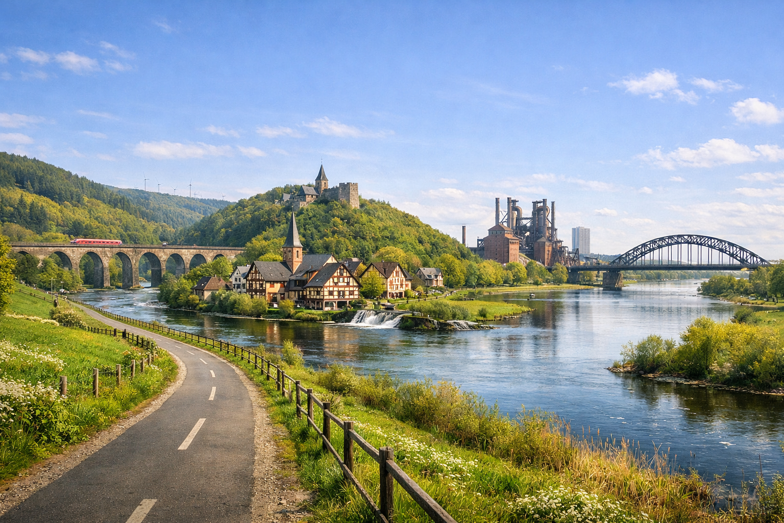
Cycle from the hills around Winterberg into the heart of the Ruhr Valley, where forested stretches give way to lively towns and traces of Germany’s industrial heritage. The route starts with a moderate challenge, then eases into a relaxed ride through Arnsberg, Witten and Essen to Duisburg, best enjoyed from April to October.

🚲 ROUTE BY DAY

Ready-made country and city routes with daily plans, sights, transport and accommodation. Buy PDF guides for independent travel.

🚲 ROUTE BY DAY


Day 1 — Winterberg → Olsberg/Meschede: start at the source of the Ruhr

  • 🚲 Start in Winterberg with a short ride out to Ruhrquelle, then descend along the RuhrtalRadweg toward Olsberg and on to Meschede. Roughly 45–52 km depending on where you stay overnight, with 3.5–4.5 hours of actual saddle time. Despite the overall descent through the valley, the first half of the day includes noticeable rolling sections and short climbs; expect ≈350–500 m of elevation gain, and more if you deliberately ride up to the source. The surface is mostly mixed: asphalt cycle paths, quiet local roads, some firm gravel, and forest sections. Difficulty is moderate for a regular touring cyclist, or closer to easy on an e-bike. Main stops along the way: Ruhrquelle as the symbolic start, Olsberg for coffee and a snack, and on a longer day, lakeside views at Hennesee before Meschede. It’s easy to refill water and buy food in Winterberg, Olsberg, and central Meschede; on the natural stretches between them, services are less frequent, so it’s better to carry at least 1.5–2 liters of water and a quick snack. Staying overnight in Olsberg makes sense if you want a gentle start, or in Meschede if you’re comfortable riding a full first stage. Road nuances: the morning section near Winterberg is the most physically demanding of the whole tour; after rain, the forest stretches can be wetter, and on a cool April start, the descent feels noticeably colder than in the valley. The day is realistic because it helps you settle into the route: the distance is touring-friendly, traffic is generally safe, and after the start the terrain begins to work in your favor.


Day 2 — Meschede/Olsberg → Arnsberg: green valley and an easy rhythm

  • 🚲 From the Olsberg or Meschede area, the route continues down the valley to Arnsberg. If you start from Olsberg, plan for 48–55 km; if from Meschede, 28–35 km. Actual saddle time is 2–4.5 hours depending on your starting point. Elevation gain is no longer significant: usually ≈150–250 m, with an overall descending profile. The surface is convenient for touring: paved cycle paths, waterfront sections, packed gravel, and occasional links on quiet roads. Difficulty is easy to moderate. Main stops: Hennesee or the Meschede waterfront, then one of the small valley villages for a break, and a finish in historic Arnsberg with a walk through the old town. Water and food are easy to get in Meschede and again closer to Arnsberg; cafés and supermarkets appear regularly in populated areas, but on longer green stretches along the river it’s better not to expect services every 5 km. The best overnight stop is Arnsberg or Neheim, where it’s easier to find food, shops, and repairs. Road nuances: in places the route shares space with pedestrians, so on sunny weekends it’s better to keep a relaxed pace; after heavy rain, there may be local detours or damp sections right by the water. This day is realistic for a regular cycle tourist because it combines a gentle profile, clear navigation, and short safe stretches between settlements.

Day 3 — Arnsberg → Witten: long, but now an easy river stage

  • 🚲 This is the longest day of the tour, but after the first hills it runs through a much flatter part of the valley. From Arnsberg to Witten, plan for 58–66 km, 4–5.5 hours of actual saddle time, with elevation gain usually up to 150–220 m. The surface is mostly touring-friendly and comfortable: separate cycle paths, river embankments, former service roads, urban cycling links, and short sections on secondary streets. Difficulty is moderate only because of the distance, but it feels significantly easier than the first days. Main stops: Fröndenberg for coffee or an early lunch, Schwerte as a convenient midpoint, and the final approach into the Witten area through the increasingly urbanized Ruhr valley. Water, bakeries, and supermarkets are easy to find in larger towns along the way; at a normal pace, two proper breaks work well. It’s best to stay overnight in Witten or Witten-Bommern near the route. Road nuances: closer to the metropolitan area there are more pedestrians, local crossings, and urban traffic lights; your speed drops, but navigation remains logical along the Ruhr. On hot summer days, it’s better to ride this stage earlier in the morning, as city asphalt warms up noticeably. The day is realistic because the long distance is balanced by a flat profile, frequent services, and good options to shorten the stage by train if needed.

Day 4 — Witten → Essen: industrial Ruhr and convenient greenways

  • 🚲 From Witten, the route leads through the denser urban fabric of the Ruhr region to Essen. Roughly 38–48 km, 3–4 hours in the saddle, with only a small amount of climbing — ≈80–150 m. The surface is among the most comfortable of the entire tour: asphalt cycle paths along the Ruhr, former railway greenways, urban cycling links, and in places short sections of street network with limited traffic. Difficulty is easy. Main stops: Hattingen or the area around Henrichshütte as a strong industrial highlight, then quiet stretches along the water, and a finish at Baldeneysee or in southern Essen. Water and food are easy to replenish almost all day: shops, bakeries, and cafés appear frequently. It’s best to stay in Essen closer to Baldeneysee, so the next day can be scenic and short. Road nuances: in the city you need to read signs carefully, avoid ending up on car interchanges, and not try to cut through fast main roads; it is safer to stick to the official RuhrtalRadweg line and cycling signposts. After rain, there are usually fewer problems here than in the forest part of the route, because the surface is mostly hard. This day is realistic for a regular tourist because the distance is moderate, the profile is simple, and there are many options for breaks and for ending the stage early if necessary.

Day 5 — Essen → Mülheim → Duisburg: lake, promenades, and the final river corridor

  • 🚲 The final full riding day goes from Essen via Baldeneysee, then toward Mülheim and on to Duisburg. Roughly 42–52 km, 3.5–4.5 hours of actual saddle time, with about 80–140 m of elevation gain. The surface is mostly asphalt and good cycle paths, with some promenades and short park sections. Difficulty is easy. Main stops: a full or half loop around Baldeneysee, then the waterside and park setting of Mülheim an der Ruhr, and the final urban approach into Duisburg’s Innenhafen. For water and food, this is one of the easiest days of the tour: cafés, supermarkets, and stations appear often along the way, and on the tourist promenades it’s easy to take a long lunch break. It’s best to stay overnight in central Duisburg or near Innenhafen, so in the morning you can ride without rushing to the symbolic end of the route. Road nuances: around Baldeneysee in season from April to October there is a lot of leisure traffic and many rollerbladers, so it’s better not to chase average speed; in windy weather, exposed lakeside and waterfront sections can feel slower. The day is realistic because it is almost completely flat, full of services, and lets you reach the finish city without overloading yourself.

Day 6 — Duisburg: short finish to Rheinorange and buffer for weather/departure

  • 🚲 It makes sense to keep day six as a short closing ride around Duisburg: from the center or the Innenhafen area to Rheinorange and the mouth of the Ruhr, then back to the station or hotel. Roughly 15–25 km depending on the loop, with 1–2 hours of actual saddle time, and almost no climbing — up to 50 m. The surface is urban and waterfront: asphalt, bike lanes, separate cycle paths, and port sections with good visibility. Difficulty is easy. Main stops: Innenhafen, the finish point at Rheinorange, and if you like, a relaxed pause on the city waterfront before departure. This is a good day for returning a rental bike, checking luggage, minor repairs, laundry, and a calm train departure. Water and food are easy to find, but right by the finish sculpture it’s better not to rely on full services, so it’s more convenient to get coffee and water in the center. Road nuances: urban intersections require attention, and in port areas it’s better to stay on marked cycle crossings and not interfere with service vehicles. This day is realistic because it leaves a buffer for bad weather, a postponed train, fatigue after five stages, and gives you a symbolically beautiful end to the whole route at the confluence of the Ruhr and the Rhine.

Flight tickets

eSIM for travel

Buy PDF guide

Buy PDF guide — 12.85 USD

PDF — 12.85 USD