
Buy PDF guide

Buy PDF guide — 12.85 USD

PDF — 12.85 USD

Germany and Austria. Bike tour along the Neckar: from Stuttgart to Heidelberg. Difficulty: easy or moderate. season: April - October.

Germany and Austria. Bike tour along the Neckar: from Stuttgart to Heidelberg. Difficulty: easy or moderate. season: April - October.

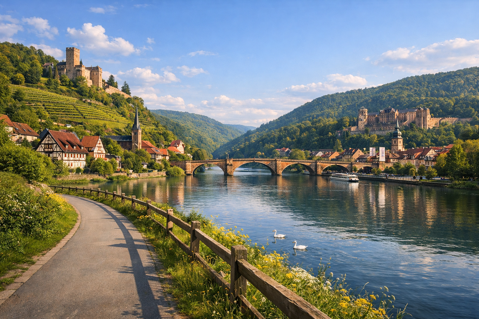
Cycle through some of southwest Germany’s most charming river scenery on this easy to moderate ride from Stuttgart to Heidelberg. Following the Neckar through vineyards, medieval old towns and peaceful valleys, the route links highlights like Marbach, Besigheim, Heilbronn, Bad Wimpfen and Eberbach before ending in romantic Heidelberg.

🚲 DAY-BY-DAY ROUTE

Ready-made country and city routes with daily plans, sights, transport and accommodation. Buy PDF guides for independent travel.

🚲 DAY-BY-DAY ROUTE


Day 1 — Stuttgart → Marbach am Neckar: a gentle start through the river valley

  • 🚲 Start in Stuttgart, finish in Marbach am Neckar. About 44 km, pure riding time around 2 h 45 min, elevation gain about 220–300 m. Surface: mostly asphalt cycle paths, embankments, urban cycle path sections, with occasional short stretches on quiet streets and firm gravel in park areas. Difficulty: easy or the lower end of moderate. This is a good first day because the officially marked Neckartal-Radweg already leads you out of the intense urban traffic after Stuttgart and onto calmer riverside sections. It makes sense to plan 2–3 stops along the way: Bad Cannstatt for a convenient city pause for coffee and water, Ludwigsburg with a possible detour to Residenzschloss and Schloss Favorite, then Remseck or Benningen before the final calm stretch to Marbach. Water and food are easiest to restock in town centers, at S-Bahn stations, and along the embankments; in April and October some kiosks may have shorter opening hours, so it is better to carry at least 1.5 liters of water and a snack. The most convenient overnight stay is in the historic center of Marbach or near the station, where it is easier both with luggage and with a backup train option. Road nuances: within Stuttgart you need to pay close attention to cycling signs and tram crossings, and after Ludwigsburg there may be short shared sections with pedestrians on the embankments. The day is realistic for an ordinary cycle tourist because the distance is moderate, the terrain gradually settles after leaving the city, and regional train stations run close to the route axis in case of fatigue or rain.


Day 2 — Marbach → Besigheim: vineyards, river bends, and a medieval finish

  • 🚲 Start in Marbach, finish in Besigheim. About 25 km, pure riding time around 2 h 05 min, elevation gain about 120–180 m. Surface: asphalt riverside cycle route, embankments, occasional compact gravel, and short urban streets when entering settlements. Difficulty: easy. This is a short and very beautiful day that works well as an enjoyable stage with unhurried stops. Main points along the way: Benningen/Freiberg for an easy warm-up, Hessigheim with views of the Felsengärten and vineyard slopes, then the confluence area near Besigheim, where it is especially pleasant to roll into the old town without rushing. For water and food, bakeries and supermarkets in Marbach before departure work well, and then cafés and dining options in Besigheim; in the warm season, the riverside sections are great for a long picnic lunch, but it is better not to rely only on seasonal kiosks. The best overnight stay is in Besigheim’s old center: from here it is convenient to walk in the evening and easy to continue the route in the morning. Road nuances: on weekends this section has a lot of leisure traffic, so it is better to keep your speed moderate and use your bell in advance. After rain, short unpaved fragments may become sticky, but they are not technical. The day is realistic even for beginners and suits those who want to combine a bike ride with a long walk through the old town and scenic viewpoints.

Day 3 — Besigheim → Heilbronn: longer, but still comfortable

  • 🚲 Start in Besigheim, finish in Heilbronn. About 48 km, pure riding time around 2 h 50 min, elevation gain about 220–320 m. Surface: mostly paved cycle paths along the river, rural roads between vineyards, and quiet local streets on approaches to towns. Difficulty: moderate. It makes sense to stop in Lauffen am Neckar, then in one of the riverside villages before Heilbronn, and at the finish leave time for the Neckarmeile and an evening walk by the water. On this stage, the wine-growing and rural side of the Neckar Valley becomes especially noticeable: the landscape remains tourism-friendly, and the valley helps keep a steady pace without hard climbs. Water and food are easy to restock in Lauffen and then in Heilbronn itself; if you are riding a regular bike without electric assist in summer, it is better to take a proper shaded break in the middle of the route. It is sensible to stay overnight in central Heilbronn near the Hauptbahnhof or close to the embankment—this makes both infrastructure and an emergency exit by train easier. Road nuances: as you approach a larger city, the number of intersections and urban sections increases, so the last kilometers go more slowly than they seem on the map. The day is realistic for a regular tourist because the route requires almost no athletic technique, and the distance remains within a comfortable range for a 6-day journey.

Day 4 — Heilbronn → Bad Wimpfen: a short transfer with a historic finale

  • 🚲 Start in Heilbronn, finish in Bad Wimpfen. About 18–22 km depending on the approach to the hotel, pure riding time around 1 h 20 min to 1 h 40 min, elevation gain about 100–180 m, but with a short steeper climb into the old part of Bad Wimpfen. Surface: urban asphalt, riverside cycle paths, embankments, and short cobbled or old-town sections at the finish. Difficulty: easy. This is an intentionally short day so that after three riding stages you still have energy left for a walk through one of the most atmospheric towns on the route. Along the way you can easily stop in Neckarsulm or have a long lunch before the climb up to Bad Wimpfen’s old center. It is convenient to restock water and food in Heilbronn before departure, and then again in Bad Wimpfen. For an e-bike, this is a good day to recharge the battery before the more natural stages ahead. The best overnight stay is in the old town or by the station if convenient logistics matter. Road nuances: the main point of the day is not the mileage itself, but the short final climb and possible cobblestones in the historic part, so with heavy bags it is better not to rush. The day is realistic for all fitness levels and works well as a half-day stage with a cultural pause.

Day 5 — Bad Wimpfen → Eberbach: the most scenic natural and most substantial stage

  • 🚲 Start in Bad Wimpfen, finish in Eberbach. About 51 km, pure riding time around 3 h, elevation gain about 300–420 m. Surface: mostly paved Neckartal-Radweg, riverside paths, quiet rural roads, with occasional firm gravel and short urban crossings in small settlements. Difficulty: moderate, in places closer to medium because of the length and the wilder character of the valley. Main stops along the way: Gundelsheim or the surroundings of the castles above the river, then Mosbach/Obrigheim or a convenient riverside break, and closer to evening the scenic natural approach to Eberbach. It is after Bad Wimpfen that the Neckar Valley becomes narrower, greener, and more dramatic: the route follows peaceful river bends and feels much less like an urban suburb. Water and food need a bit more planning than in the first days: services exist, but they are not always available “every five minutes,” especially in the shoulder season and on Sundays. It is best to stay overnight in Eberbach in the center or near the station: the town is very convenient as a cycling base and has good railway backup. Road nuances: in hot weather this day may feel harder because of less urban shade and longer quiet stretches; in rain some gravel fragments become slower, though not more dangerous if ridden carefully. The day is realistic because the terrain remains touring-friendly, and the distance itself is typical for a multi-day river cycling route.

Day 6 — Eberbach → Heidelberg: a romantic finale along the Neckar

  • 🚲 Start in Eberbach, finish in Heidelberg. About 37 km, pure riding time around 2 h 30 min, elevation gain about 180–260 m. Surface: asphalt cycle paths, quiet riverside sections, occasional compact gravel, and urban embankments on the final approach into Heidelberg. Difficulty: easy or moderate. Along the way it is worth making 1–3 stops: Hirschhorn with its beautiful silhouette above the water, Neckarsteinach with views of the castles, then a final slow entrance into Heidelberg with a possible pause by the river before checking in. This is one of the most photogenic days of the whole tour: the wooded slopes of the Odenwald come almost right down to the water, and the road gradually leads into the famous university town. For water and food, stations and bakeries in Hirschhorn or Neckarsteinach work well, and in Heidelberg the full range of city options is already available. It is best to stay overnight in Heidelberg west/central or near the Hauptbahnhof if you plan to leave by train the next day; for evening walks in the Altstadt, a base closer to the center is more convenient. Road nuances: on the final kilometers, urban bike and pedestrian traffic increases, so it is better to enter Heidelberg before dusk and choose a bicycle parking spot in advance before visiting the old town. The day is realistic because it is shorter than the previous one, beautifully completes the route, and still leaves energy for a walk around Heidelberg without the feeling of a race.

Flight tickets

eSIM for travel

Buy PDF guide

Buy PDF guide — 12.85 USD

PDF — 12.85 USD