
Buy PDF guide

Buy PDF guide — 29.99 USD

PDF — 29.99 USD

France and the Alpine Rings. Chamonix, Zermatt. Season (July-August) (without glaciers, on hiking trails).

France and the Alpine Rings. Chamonix, Zermatt. Season (July-August) (without glaciers, on hiking trails).

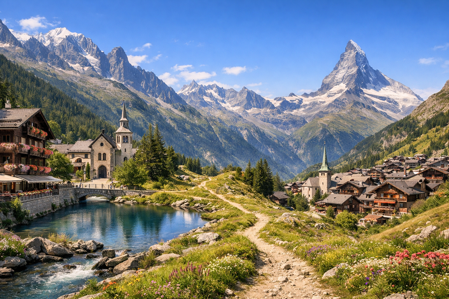
France and the Alpine Rings in high summer mean crisp mountain air, flower-lined trails, and classic Alpine villages beneath dramatic peaks. From Chamonix through Servoz and Les Houches to Zermatt, this route is all about scenic hiking, sunny terraces, and big mountain views without stepping onto the glaciers.

🥾 DAY-BY-DAY ROUTE

Ready-made country and city routes with daily plans, sights, transport and accommodation. Buy PDF guides for independent travel.

🥾 DAY-BY-DAY ROUTE


Day 1 — Chamonix: a gentle acclimatization walk through the valley and forest paths

  • 🥾 A calm start to the route: a walk along the lower trails of the Chamonix valley, by the Arve river and along green paths around the center and Les Bois. Type of walk: valley, forest, meadows, scenic clearings. Active part of the day ≈ 2–3 hours, difficulty easy, distance usually 5–7 km, elevation gain minimal. This is a good day for a regular tourist without special gear: wide trails, easy navigation, and you can always shorten the route and return to the center by bus or on foot. In July–August it is better to set out in the morning or closer to the evening: it can be warm down below, and during the day the center of Chamonix is lively. It is also useful to stop by the tourist office the same day and check the condition of the high-mountain trails for the coming days, because even in summer some sections above 2000 m may still depend on lingering snow or thunderstorms.


Day 2 — Argentière → Les Bois: Petit Balcon Nord trail

  • 🥾 One of the best easy walks in the Chamonix valley is the Petit Balcon Nord between Argentière and Les Bois. Type of walk: forest, villages, a balcony trail above the valley, streams, and open views of the Mont Blanc massif. Active part ≈ 1 hr 45 min of walking time, but with stops it is comfortable to allow 3–4 hours; difficulty easy; distance about 6 km; elevation gain about 124 m, descent about 296 m. The route suits a regular tourist because it is a well-known, marked, and non-technical mid-altitude trail with no glacier sections and no need for alpine equipment. It is convenient to get to Argentière by train or bus, and from Les Bois return to Chamonix by local transport. After rain, some forest sections can be slippery, so shoes with good soles are needed.

Day 3 — Chamonix: Grand Balcon Nord from Plan de l’Aiguille to Montenvers

  • 🥾 One of the most spectacular yet still tourist-friendly routes in the valley: Grand Balcon Nord from Plan de l’Aiguille to Montenvers. Type of walk: high-mountain balcony traverse, panoramas of granite peaks, moraine landscapes, viewpoints. Active part ≈ 2 hr 30 min of walking time; difficulty moderate; distance about 5.7 km; elevation gain about 140 m, descent about 523 m. The trail suits a regular prepared tourist without special equipment if you stick only to the official panoramic variant, do not shortcut through dangerous gullies, and choose dry stable weather. It is convenient to take the cable car up to Plan de l’Aiguille for the start and finish at Montenvers. An important seasonal nuance: the route usually depends on lift operations and favorable snow conditions; in July and August you should start not too late and watch out for afternoon thunderstorms.

Day 4 — Chamonix: Lac Blanc from the Flégère/Index area

  • 🥾 A classic hiking day to Lac Blanc — the mirror lake in the heart of Aiguilles Rouges. Type of walk: alpine meadows, a rocky but popular trail, lake, panoramas of Mont Blanc. If using the lift up to Flégère and Index, the active part is ≈ 2 hr 45 min round trip from the upper station; difficulty moderate; distance about 2.9 km by the short option from Index; elevation gain about 30 m on the officially described variant, though the effort feels greater because of the altitude. For a regular tourist, this is one of the best safe ways to see high-mountain scenery without glaciers or mountaineering. It is important to stick only to the popular route from the lift and not choose the more difficult approaches from Tré-le-Champ or Col des Montets unless you are confident. Seasonal nuances: access depends on the opening of Flégère/Index and lingering snow; the lake is in a nature reserve, swimming is forbidden, and dogs are not allowed here.

Day 5 — Col des Montets and the Aiguilles Rouges reserve: visitor center and easy nature trails

  • 🥾 After two higher-mountain days — an easier day around Col des Montets and the visitor center of the Aiguilles Rouges nature reserve. Type of walk: subalpine meadows, botanical sections, viewpoints, nature interpretation. Active part ≈ 2–4 hours at a relaxed pace; difficulty easy; distance depends on the chosen loop, usually 4–7 km; elevation gain small. This kind of day is excellent for regular tourists: you can combine short marked walks with a visit to the information center without heading onto difficult high routes. In July–August it is especially beautiful here because of the alpine flora, but you need to watch out for the sun: there is little shade in the open sections. This day is also useful as a backup if the lake or balcony trails were closed the day before because of weather.

Day 6 — Servoz: Gorges de la Diosaz

  • 🥾 A very photogenic day in the Diosaz gorge near Servoz. Type of walk: canyon, suspended walkways, water, cool forest shade, cascades, and rock walls. Active part is usually 1.5–2.5 hours, difficulty easy, distance short, elevation gain moderate because of stairs and bridges. This is an excellent route for a regular tourist: the trail is equipped, well known, and visited, giving a sense of “wild nature” without the technical danger of alpine routes. After visiting the gorge, you can add a short walk around the village of Servoz or have a picnic. Seasonal nuances: after heavy rain or during maintenance there may be temporary restrictions, and the wooden walkways can be slippery; it is better to have non-slip shoes and a light jacket against spray.

Day 7 — Les Houches: walk to Parc de Merlet and scenic meadows

  • 🥾 A day in the Les Houches area with an ascent to Parc de Merlet or a park visit with short walks around it. Type of walk: forest, sunny pastures, scenic terraces facing Mont Blanc, alpine wildlife. Active part ≈ 2–3 hours in and around the park; if you walk up from Les Houches, the day becomes longer and closer to a moderate level. This direction suits regular tourists because there is no difficult navigation, and the main value is a gentle nature walk and magnificent panoramas rather than a sporting challenge. An important seasonal nuance: in July–August visiting the park requires mandatory booking, and in hot weather animals are best observed closer to evening. There are free summer shuttles on certain days, but the schedule should be double-checked in advance.

Day 8 — Transfer Chamonix → Zermatt and an evening walk through the village

  • 🥾 A travel day with a reasonable load: from Chamonix via the Mont Blanc Express valley route and then along the Swiss rail network to car-free Zermatt. Type of activity: travel, a short walk through the alpine village, promenades, and viewpoints in the evening light. Allow almost the whole day for the journey: depending on connections, the route usually takes about 5.5–7 hours. After check-in — an easy 1–2 hour walk, difficulty easy, with no significant elevation gain. This rhythm makes the itinerary realistic and helps you recover before the Swiss trails. In the evening it is useful to buy or activate tickets for mountain lifts/railways and check the morning forecast again: in Zermatt, high-mountain walks depend especially on visibility and wind.

Day 9 — Zermatt: Marmot Trail from Blauherd to Sunnegga

  • 🥾 The ideal first hike in Zermatt is the themed Marmot Trail. Type of walk: sunny alpine slopes, grassy meadows, boulder fields, viewpoints, and a chance to see marmots. Active part ≈ 1 hr 10 min of walking time; difficulty moderate but close to easy; distance about 3.8 km; elevation gain/change about 249 m. The route suits a regular tourist without special gear: it is short, well known, officially recommended as family-friendly, starts with a lift up to Blauherd, and goes downhill toward Sunnegga. In July–August the sun is strong here and there is little shade, so water, a cap, and an early start are especially important. If you want a longer day, you can linger at Stellisee and the viewpoints.

Day 10 — Zermatt: 5-Seenweg, the five Matterhorn lakes

  • 🥾 One of the region’s most famous routes is the Five Lakes Trail. Type of walk: mountain lakes, flowering slopes, streams, forest sections in the lower part of the route, and continuous views of the Matterhorn. Active part ≈ 2 hr 30 min of walking time; difficulty moderate; distance about 9.8 km; elevation difference about 454 m according to the English-language route description. For a regular tourist, this is an excellent trail: no glaciers, no technical sections, and logical navigation from Blauherd to Sunnegga. In summer the trail is very popular, so it is better to go early in the morning — both for the soft light at Stellisee and to avoid crowds. Swimming is not officially allowed everywhere: follow only local signs. During thunderstorms, you should not linger on exposed sections.

Day 11 — Zermatt: Sunnegga → Findeln → Ried → Zermatt

  • 🥾 A calmer panoramic day on the sunny side of the valley through Findeln. Type of walk: alpine meadows, old mountain hamlets, larches, gentle descents, and open views of the Matterhorn. Active part ≈ 2 hr 25 min; difficulty moderate; distance about 7 km; elevation difference about 542 m on the Sunnegga – Findeln – Ried – Zermatt route. This day suits regular tourists because the trail is non-technical, descends logically toward the village, and gives plenty of chances to stop in hamlets and at terrace restaurants. In hot weather, sun protection is again important here; after rain some dirt sections may be slippery, but overall this is one of the most comfortable and postcard-perfect days of the whole trip.

Day 12 — Zermatt: Riffelsee and the Sunshine Trail to Riffelberg

  • 🥾 A day for classic Matterhorn views and Lake Riffelsee. Take the Gornergratbahn up, then you can start with a short walk in the Rotenboden/Riffelsee area and continue along the Sunshine Trail to Riffelberg. Type of walk: high-mountain meadows, rocky trails, views of 4000-meter peaks, lake, and a broad panorama. The Sunshine Trail itself takes about 1 hour; difficulty moderate; distance about 3.1 km. If you add the walk to the lake and viewpoints, the active part of the day will be 2–3 hours. This option is safe for a regular tourist: it is a well-known walking sector with the railway nearby, the route is short, and it requires no special equipment. Important seasonal nuances: the morning light at Riffelsee is often better for the Matterhorn reflection, but at altitude it is cooler and windier than in the village.

Day 13 — Zermatt: Path of Silence to Riffelalp

  • 🥾 The most contemplative day of the Swiss part — the Path of Silence from Gornergrat to Riffelalp. Type of walk: high-mountain landscapes, small lakes, alpine meadows, sparse Swiss stone pine woodland, and quiet scenic stretches. Active part ≈ 3 hr 15 min; difficulty moderate; distance about 7.9 km. The route suits a regular tourist with basic endurance: it is an official walking trail with a gradual descent, no glacier crossings, and no mountaineering techniques. But because of the altitude, you should walk at a calm pace, bring a wind jacket, and not underestimate the sun. In July–August the day is long, which is convenient for a leisurely pace and a picnic, though visibility may worsen after midday or a thunderstorm may develop.

Day 14 — Zermatt: easy walk at Riffelalp or a free day at Leisee before departure

  • 🥾 It is best to keep the final day easy and flexible. The main option is a short circular walk at Riffelalp: forest, alpine clearings, quiet sections under larches, and soft views of the Matterhorn. Active part ≈ 1 hour; difficulty easy; distance about 3 km. An alternative is to go up to Sunnegga and relax by Leisee with short walks around the area. This format suits a regular tourist perfectly: minimal physical effort, a beautiful end to the trip, and a buffer for weather, fatigue, or train changes. In the height of the season, this is a good day for a slow pace, buying last food for the road, and departing without rushing.

Flight tickets

eSIM for travel

Buy PDF guide

Buy PDF guide — 29.99 USD

PDF — 29.99 USD