
Buy PDF guide

Buy PDF guide — 29.99 USD

PDF — 29.99 USD

France and the Alpine loops. GR54 - Circular route around the Écrins massif. Season (July-August). Difficulty: high

France and the Alpine loops. GR54 - Circular route around the Écrins massif. Season (July-August). Difficulty: high

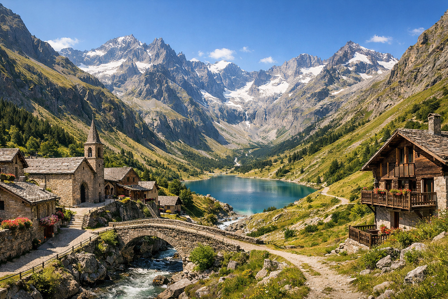
France’s GR54 is a demanding Alpine loop circling the wild Écrins massif, linking rugged cols, high pastures, and dramatic glacial valleys. Best hiked in July and August, this high-difficulty route passes through iconic mountain villages like Le Bourg-d’Oisans, La Grave, and Vallouise-Pelvoux for a classic taste of the French Alps.

🥾 DAY-BY-DAY ROUTE

Ready-made country and city routes with daily plans, sights, transport and accommodation. Buy PDF guides for independent travel.

🥾 DAY-BY-DAY ROUTE


Day 1 — Le Bourg-d’Oisans: Lac du Lauvitel and a gentle introduction to the Écrins

  • 🥾 It’s best to dedicate the first day to one of the most famous walks in Oisans — to Lac du Lauvitel. This is a mountain lake set in a forested and rocky alpine bowl, usually reached in 4–5 hours round trip. According to current information, the route follows the right bank; the left approach is periodically closed because of rockfalls, so before setting out it’s worth checking trail conditions at the Maison de l’Oisans et du Parc national des Écrins. Approximate walk stats: ≈9 km, elevation gain about 500–600 m. It feels like a moderate walk, but with a mountain gradient. The trail is well known, marked, and popular, with no mountaineering sections and no need for special equipment — you only need comfortable boots, water, and sun protection. In July and August it can get hot here even in the morning, and by midday the climb on the southern sections quickly feels stuffy, so it’s best to start early. It’s an excellent day to see the natural character of the Écrins: dark forest, boulders from an ancient landslide, clear water, and the first big panoramas.


Day 2 — Saint-Christophe-en-Oisans: Vallon de la Selle valley

  • 🥾 Today is a longer, but still purely hiking and non-technical walk toward Refuge de la Selle through Vallon de la Selle. This is a day of mountain valley scenery, alpine meadows, and broad glacier views without going onto the glacier. The active part of the day takes 6–7 hours; a convenient format for an ordinary traveler is to hike to the refuge or a bit higher to viewpoints and return the same way, without entering high mountain passes. Roughly 12–14 km, elevation gain about 700–850 m. Difficulty is moderate, leaning toward strenuous because of the duration. The route is suitable without special equipment if you stay on the main trail, avoid snow patches, and don’t try to continue toward the glacier zone. In July, some snow remnants can still remain on the upper sections after a long winter, and after thunderstorms the trail becomes slippery. This is one of the most beautiful days of the route: the Vénéon stream, stone slopes, high peaks, and the feeling of a truly grand alpine valley.

Day 3 — Transfer to La Grave and a walk in the Villar-d’Arène arboretum

  • 🥾 After two active days, it makes sense to have an easier day with a transfer to La Grave. On the way and after check-in, a short walk around Arboretum de Villar-d’Arène and the lower sections of the GR54 works well. This is a forest day with gentle views over the valley, mountain meadows, and glacier-capped peaks. The walking part takes 1.5–3 hours, usually 4–6 km with little elevation gain, difficulty easy. A day like this suits an ordinary traveler well: the trails are clear, close to the road and village, and you can quickly return if the weather changes. In July–August it’s pleasant to walk here in the second half of the day, but it’s important to watch for afternoon thunderstorms and not stay out until dark. It’s a calm adjustment to the new base and a good way to see the northern side of the GR54 loop without overloading yourself.

Day 4 — La Grave: Plateau d’Emparis and Lakes Lérié and Noir

  • 🥾 One of the classic days of the whole area is Plateau d’Emparis with views of La Meije and a walk to the alpine lakes Lac Lérié and Lac Noir. This is a day of mountain meadows, panoramic plateaus, and mirror-like lakes. In an easier format for an ordinary traveler, it’s convenient to start from Le Chazelet or from the upper parking approach so you don’t have to do too much elevation change. The active part takes 5–6 hours, approximately 10–13 km with ≈400–650 m of ascent depending on the starting point. Difficulty is moderate. The route is excellent without special gear: it’s a popular marked trail through pastures and broad mountain paths, with no technical rocky sections. In season it’s important to set off early: midday sun on the plateau is very harsh, there is almost no shade, and the weather changes quickly. On weekends and in August there can be many people and cars here, so an early start also helps with parking.

Day 5 — La Grave: viewpoint day by the La Meije glaciers without difficult trekking

  • 🥾 Today it’s best to make it a scenic and shorter day to save energy. A safe option is to go up to the panoramic area connected with the Téléphérique des Glaciers de la Meije and take a short walk to Refuge Evariste Chancel or along the nearest viewpoints, without stepping onto the glacier or continuing into technical terrain. This is a day of high mountain views, rock faces, glacier panoramas, and photo spots. The walking part usually takes 1–2.5 hours, distance 2–5 km, with moderate ascent. Difficulty is easy. For an ordinary traveler this option is good because it requires no mountaineering experience: the ascent is by cable car, and the walk follows a known trail to the refuge. But it’s important to remember that this is already altitude, where it can be quite cold even in August, with wind, fog, and patches of old snow near the trail. If visibility is poor or the cable car isn’t running because of wind, this day should be replaced with a walk in the valley near La Grave.

Day 6 — Transfer to Le Monêtier-les-Bains and the Le Casset valley

  • 🥾 The transfer to Le Monêtier-les-Bains is short, so it’s convenient to do an easy walk the same day around Le Casset and the reception center of Parc national des Écrins. This is a day of forest, river valley, and quiet meadow trails. The walking part is 2–3.5 hours, about 5–8 km, with little elevation gain, difficulty easy. This format is especially good after changing bases: you can check the forecast, the condition of the next trails, and avoid overloading your legs. For an ordinary traveler everything is comfortable here — the trails are easy to follow, settlements are nearby, and if needed you can quickly end the route. In July and August it’s pleasant to walk closer to evening, but you should keep some daylight in reserve: in the mountains dusk comes faster than it seems, and the last buses from the valley may be infrequent.

Day 7 — Le Monêtier-les-Bains: Lac de l’Eychauda

  • 🥾 The main walk from this base is Lac de l’Eychauda from Chambran. This is a classic day of a high mountain valley and a lake surrounded by moraines and harsh alpine terrain, but without any need to go onto passes or glacier sections. Official route information indicates an ascent on a sunny southeast-facing slope, so it’s best to begin the active part early. Approximate stats: 5–6 hours round trip, about 10–12 km, elevation gain ≈700–800 m. Difficulty is moderate. The route suits an ordinary traveler in good shape: the trail is marked, popular, and requires no special gear, but this is already a full mountain day. Important seasonal nuances: in July, snow tongues sometimes linger on the upper sections, and there can be a cold wind by the lake even in hot weather. Because of the heat on the ascent, you need to carry enough water and not start late.

Day 8 — Le Monêtier-les-Bains: a calmer day in the Guisane valley

  • 🥾 After Eychauda, a gentle day is needed. The best format is a walk on the lower trails of the Guisane valley, historic paths around the village, and to thermal and meadow panoramas. If you want, you can add a short family-friendly route toward the streams and forest sections near Monêtier or Le Casset. This is a day of forest, village landscape, rivers, and calm views. The walking part is 2–4 hours, 5–9 km, with little elevation gain, difficulty easy. A day like this suits an ordinary traveler perfectly: no altitude strain, and you can rest, do laundry, use the spa or thermal baths, and still remain in a beautiful natural setting. In season it’s important to keep afternoon thunderstorms in mind: it’s better to choose a morning walk and leave the second half of the day free.

Day 9 — Transfer to Vallouise-Pelvoux and a walk in Ailefroide

  • 🥾 Today the route moves to Vallouise-Pelvoux, one of the most convenient bases for a non-extreme introduction to the southern part of the Écrins. After the transfer, a walk around Ailefroide and the lower forest trails works well — for example, an easy loop among larches and along the gorge. This is a day of forest, granite walls, streams, and cool mountain shade. The active part is 2–3 hours, usually 4–7 km, with little elevation gain, difficulty easy. This kind of walk is very suitable for an ordinary traveler: the trails are accessible, close to the road and hamlet, and the scenery is already impressive without a heavy climb. In July and August, Ailefroide offers pleasant coolness, but after rain the roots and stones can be slippery. It’s an excellent breather day before the big outing to Pré de Madame Carle.

Day 10 — Vallouise-Pelvoux: Pré de Madame Carle and the approach to Glacier Blanc

  • 🥾 This is one of the essential days of the route, but in a safe version: a walk from Pré de Madame Carle along the marked trail toward Refuge du Glacier Blanc or to a convenient viewpoint over the glacier basin, without going onto the glacier itself. This is a day of a grand mountain valley, moraines, waterfalls, and magnificent views of the glacier part of the massif. According to current tourist information, this is a popular summer route, accessible on foot to people in good shape. The active part is 4–5 hours, approximately 8–10 km, with elevation gain ≈650–700 m. Difficulty is moderate. The route suits an ordinary traveler if you stay on the trail and viewpoints, do not continue onto the glacier, and do not try to go farther into mountaineering zones. Important seasonal details: you need to check whether the road to Pré de Madame Carle is open, the condition of footbridges over streams, and the operation of the summer shuttle from Vallouise; the place is very popular, so an early start is essential.

Day 11 — Vallouise-Pelvoux: Maison du Parc and easy valley trails

  • 🥾 After Glacier Blanc, it’s good to have a recovery day. Start with Maison du Parc de Vallouise, where it’s convenient to check trail conditions, then choose one of the lower valley walks: along the water, through meadows and larch forests, with gentle views of the peaks. This is a day of the natural park and a cultural introduction to the area without museum overload. The walking part is 2–4 hours, 5–8 km, minimal elevation gain, difficulty easy. This format is ideal for ordinary travelers: there’s no long climb, and you can quickly adjust the route to the weather. In July and August the valley can get hot during the day, so it’s nicer to walk in the morning or closer to evening. It’s also a good moment for laundry, buying snacks, and an early night before a long transfer.

Day 12 — Transfer to La Chapelle-en-Valgaudemar and a walk to Gioberney

  • 🥾 The transfer to La Chapelle-en-Valgaudemar takes a noticeable part of the day, so the route should be easy. An excellent option is to drive to Gioberney and take a short scenic walk on the lower trails near the glacial cirque, waterfalls, and riverside spots. This is a day of gorge scenery, cascades, cliffs, and dramatic mountain scenery without difficult hiking. The active part is 1.5–3 hours, distance 3–6 km, with little elevation gain, difficulty easy. For an ordinary traveler this is a safe way to see one of the most spectacular valleys in the Écrins: easy access, clear trails, and the option to shorten the walk at any time. In July–August it’s important to watch parking and the timing of the drive back down the road, and after heavy rain to check trail conditions with the local office or maison du parc.

Day 13 — Valgaudemar: Lac du Lauzon by the Gioberney cirque

  • 🥾 The main hiking day from this base is Lac du Lauzon from the Gioberney parking area. This is a very beautiful route to a high mountain lake with waterfalls and a panorama of the glacial cirque. According to the current description, the active part of the trail takes about 3 hours, with stats of ≈6.6 km and +442 m, and the format is a loop. Difficulty is moderate, but with no technical obstacles. For an ordinary traveler, the route is well suited: it’s a known trail, easy to follow, and needs no special equipment. However, the park explicitly warns that passage conditions change after thunderstorms, floods, and winter damage, and that footbridges and accessibility depend on the season, so before setting out you must definitely check the conditions. July–August is the best period, but also the busiest, so once again an early departure works best.

Day 14 — Valgaudemar: gentle finish on the valley trail and viewpoints

  • 🥾 It’s best to keep the final day relaxed: a short walk through the lower Valgaudemar valley, to riverside sections, meadows, and viewpoints near La Chapelle-en-Valgaudemar, without any ambitious elevation gain. This is a day of forest, valley, water, and saying goodbye to the route. The walking part is 2–3 hours, 4–7 km, difficulty easy. This format suits an ordinary traveler perfectly: you can sleep in, pack slowly, take one last walk, and calmly prepare for departure. In season, it’s still worth going out in the morning, because afternoon thunderstorms in the Alps are not uncommon even at the height of summer. It’s a good day to finish the trip without rushing and with the feeling that you saw the Écrins not through mountaineering, but through its most beautiful and accessible natural trails.

Flight tickets

eSIM for travel

Buy PDF guide

Buy PDF guide — 29.99 USD

PDF — 29.99 USD