
Buy PDF guide

Buy PDF guide — 17.14 USD

PDF — 17.14 USD

French Alps - Annecy - Chamonix - Grenoble - Val d’Isère - Mountain campsites, parking lots near lifts, overnight stays only in permitted places

French Alps - Annecy - Chamonix - Grenoble - Val d’Isère - Mountain campsites, parking lots near lifts, overnight stays only in permitted places

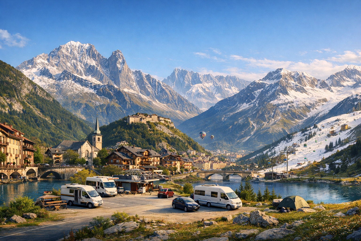
From the turquoise waters of Annecy to the dramatic peaks above Chamonix, the French Alps pack lake views, mountain roads, and classic alpine towns into one unforgettable route. Continue through Grenoble to Val d’Isère for high-altitude scenery and easy access to trails and lifts, with mountain campsites and designated overnight parking making it simple to stop in all the right places.

🚗 DAY-BY-DAY ROUTE

Ready-made country and city routes with daily plans, sights, transport and accommodation. Buy PDF guides for independent travel.

🚗 DAY-BY-DAY ROUTE


Day 1 — Annecy: a calm lakeside start and first mountain acclimatization

  • 🚗 Start of the day — Annecy, finish — Annecy. Approximate distance: 35–55 km around the city and surroundings, pure driving time: 1–1.5 hours. This is an easy introductory day after picking up the car: convenient for checking in, checking parking, buying water and groceries, and getting used to French road markings and roundabouts. Main stops: Annecy old town, the Le Pâquier waterfront, a viewpoint drive up to Semnoz, or a short outing to Talloires/Menthon-Saint-Bernard. It is better to leave the car in an official city parking area and walk through the center, because the streets in vieille ville are narrow and have restrictions. Overnight stay — in a hotel in Annecy or at an official lakeside campground. Road nuances: in summer the center can be busy and parking spaces scarce, so it is convenient to arrive at parking before noon; in the evening traffic by the lake is calmer. The day is realistic for an average driver because it offers a gentle start without long transfers and avoids driving tired straight into the high Alps.


Day 2 — Annecy and the lake loop: Semnoz, Talloires, and pass views without overload

  • 🚗 Start of the day — Annecy, finish — Annecy. Approximate distance: 70–95 km, pure driving time: 2–2.5 hours. Main stops: Semnoz, Talloires-Montmin, and Col de la Forclaz above Lake Annecy. In the morning it is worth driving up to Semnoz: this is a safe and popular scenic drive with official P1/P2 parking near the activity area. Then return to the lake and make a loop along the eastern shore through Talloires, enjoying the color of the water and the steep slopes. After that, it makes sense to go up to Col de la Forclaz for one of the best panoramas of Lac d’Annecy; park only in marked bays and do not block the roadside on the hairpins. Overnight stay — at the same base in Annecy so you do not have to repack. Road nuances: the mountain roads are short, but viewpoints get crowded on weekends; on narrow sections it is better to avoid rushed passing with oncoming traffic and not plan the ascent in the dark. The day is realistic because the route is circular, with short sections and many places for breaks.

Day 3 — Annecy → Chamonix: through mountain villages and pass views toward Mont Blanc

  • 🚗 Start of the day — Annecy, finish — Chamonix-Mont-Blanc. Approximate distance: 120–145 km depending on stops, pure driving time: 2.5–3.5 hours. Main stops along the way: La Clusaz, Col des Aravis, and Megève or Sallanches as a more practical coffee and fuel break. This is a beautiful transfer where the flat lakeside atmosphere gradually gives way to the harsher scenery of the Mont Blanc massif. At Col des Aravis it is convenient to make a short photo stop, but parking should be only in designated areas, not right on the road edge. Before entering the Chamonix valley, it is wise to refuel in larger towns, because prices in the resort area are often higher. In Chamonix, it is best to go straight to official parking at the hotel or campground and then use walking routes or local transport. Overnight stay — in a hotel in the valley or at the official Les Bossons/Chamonix valley campground. Road nuances: mountain weather changes quickly, and there may be traffic jams on the approaches to Chamonix in season; if you plan to continue toward the Mont Blanc tunnel, you need to check the live road status separately. The day is realistic for an average driver: one straightforward transfer, 2–3 stops, and arrival before dark.

Day 4 — Chamonix: Aiguille du Midi, Montenvers, and parking discipline in the valley

  • 🚗 Start of the day — Chamonix, finish — Chamonix. Approximate distance: 20–35 km, pure driving time: about 1 hour. Main stops: central Chamonix, the Aiguille du Midi station, and the Montenvers/Mer de Glace area. On this day the car is useful as a base, but the route itself is best planned so that you park in an official lot in the morning and then move on foot or by public transport in the valley. Morning — ride up to Aiguille du Midi, then a walk around town and a trip on the cog railway to Mer de Glace. In Chamonix it is very important to follow the rules: overnight stays in parking lots and adjacent streets are prohibited, so you can stay overnight only in official accommodation or on an authorized camper area. Overnight stay — the same base in Chamonix. Road nuances: the resort center is busy, some streets are awkward for maneuvering, and parking is paid and popular; it is best to arrive early for the cable cars. The day is realistic because it is not a day of big transfers, but a day focused on high-mountain views, where the car serves for comfortable logistics rather than endless driving.

Day 5 — Chamonix → Grenoble: longer, but on faster roads through the valleys of Savoie

  • 🚗 Start of the day — Chamonix, finish — Grenoble. Approximate distance: 185–220 km, pure driving time: 3–4 hours. Main stops: Sallanches for convenient refueling, Albertville or Chambéry for lunch and a short walk, then arrival in Grenoble. This is the most transport-heavy day of the route, but it is logical: most of the way follows faster roads rather than endless mountain passes. If you want to make the day more scenic, you can choose one short panoramic stop somewhere in Savoie, but do not spread yourself across too many places. In Grenoble, after check-in, it is convenient to go up to the Bastille cable car and see how the Alpine massifs converge around the city. Overnight stay — in a city hotel with parking. Road nuances: toll sections of motorway are possible, and in larger cities you should pay extra attention to bus lanes and one-way streets. The day is realistic because it is long only in mileage, not in driving difficulty.

Day 6 — Grenoble and Vercors/Chartreuse: an urban Alpine day without heavy driving

  • 🚗 Start of the day — Grenoble, finish — Grenoble. Approximate distance: 60–100 km, pure driving time: 1.5–2.5 hours. Main stops: Bastille de Grenoble, one of the viewpoint stretches in the direction of Vercors or Chartreuse, and return to the center in the evening. In the morning it is worth leaving the car in an official parking area and taking the famous Téléphérique de la Bastille “bubbles” up. After that, you can do a short scenic loop in the foothills — for example toward Saint-Nizier-du-Moucherotte or to one of the safe viewpoint areas, without turning the route into a distant hairpin-road drive. Overnight stay — again in Grenoble. Road nuances: exits from the city require attention to tram lines and urban speed limits, and on scenic roads there is no need to chase big mileage — it is better to choose one clear panorama and a calm pace. The day is realistic because it combines urban relaxation and a small scenic drive without turning the trip into a tiring forced march.

Day 7 — Grenoble → Val-d’Isère: into Tarentaise via Albertville and Bourg-Saint-Maurice

  • 🚗 Start of the day — Grenoble, finish — Val-d’Isère. Approximate distance: 165–190 km, pure driving time: 3.5–4.5 hours. Main stops: Albertville, Bourg-Saint-Maurice, and, if desired, parking by the Les Arcs funicular as a convenient scenic break without an extra detour. After Grenoble, the route heads into Tarentaise, where the valley gradually narrows and the road becomes more mountainous, but remains a major tourist artery. Bourg-Saint-Maurice is the best point for topping up fuel, shopping, and resting before the final climb on the D902. On arrival in Val d’Isère, it is best to leave the car in official hotel parking or one of the designated village/Q-Park car parks. Overnight stay — in a hotel in Val-d’Isère; for this high-altitude base it is better to rely on regular accommodation, because official campgrounds for overnight stays are limited and sleeping in the car in parking lots is prohibited. Road nuances: the final section requires attention to weather, avalanche conditions in winter, and the general state of the road; in summer it is usually easy, but still it is better not to arrive too late. The day is realistic because after a morning departure there is still enough time for a calm ascent to the resort.

Day 8 — Val-d’Isère and the high-mountain panorama of Vanoise: lifts, parking, and the final Alpine point

  • 🚗 Start of the day — Val-d’Isère, finish — Val-d’Isère. Approximate distance: 25–45 km, pure driving time: 45–75 minutes. Main stops: La Daille, central Val d’Isère, Le Fornet, or Manchet depending on open sections and the season. This is a day for short car transfers between lift parking areas, walks around the village, and getting to know the landscapes near the edge of the Vanoise massif. In summer, free parking is available in some parts of the village, but you should use only official parking areas; at the bus/camper/van parking area in the village it is clearly stated that sleeping in the car is not allowed, and the area is also exposed to avalanche risks. If you want to minimize driving, you can leave the car parked for the day and move around the resort locally. Overnight stay — in a hotel in Val-d’Isère or departure onward according to your own plan. Road nuances: some local roads and access to lifts may change by season; before the trip you should check local conditions, especially in the shoulder season. The day is realistic because the route finale does not require a long drive and leaves time for nature, photos, and a calm departure.

Flight tickets

eSIM for travel

Buy PDF guide

Buy PDF guide — 17.14 USD

PDF — 17.14 USD